Broadcast Seeding Suitability: A Smarter Way to Plan Drone Seeding Missions
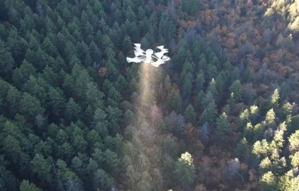
Post-fire restoration and rangeland recovery often begin with a simple question: where should the seed go first? Traditional broadcast seeding methods often treat large areas as if they are uniform, but field conditions rarely support that assumption. Terrain, vegetation, burn severity, access, slope, and surface conditions can all influence whether a location is truly suitable for aerial seeding.
Broadcast Seeding Suitability, or BSS, was developed to support a more informed answer to that question. Rather than treating every acre the same, BSS provides a planning framework for identifying where drone-based broadcast seeding is likely to be most effective, practical, and defensible.
The concept is straightforward. Drone mapping, terrain interpretation, and site analysis can be used to evaluate the characteristics of a landscape before seed is ever loaded into the aircraft. This allows land managers, contractors, and restoration teams to move from generalized coverage to a more strategic approach built on actual site conditions.
Why a Suitability Approach Matters
Large restoration areas rarely behave uniformly. Within the same project boundary there may be accessible benches, narrow drainages, exposed ridges, unstable slopes, and areas of highly variable vegetation recovery. Some locations may be strong candidates for broadcast seeding, while others may offer limited return or introduce operational inefficiencies.
A suitability-based method helps shift the conversation from simple coverage to informed placement. That is important for both operational success and stewardship. When seed, labor, aircraft time, and environmental windows are limited, planning should focus on where treatment has the greatest potential value.
For agencies, Tribes, landowners, and restoration partners, that kind of planning discipline can improve communication, reduce waste, and strengthen confidence in the treatment strategy.
How BSS Fits into Drone-Based Restoration Planning
Drone platforms now make it possible to capture detailed site data across large and complex terrain. Orthomosaics, digital surface models, terrain analysis, and related products can reveal patterns that are difficult to recognize from the ground alone. Those products become more valuable when they are used not only for mapping, but also for operational decision-making.
BSS is designed to sit at that intersection of mapping and action. It is not just about collecting imagery. It is about translating mapped conditions into a clearer understanding of where broadcast seeding may make sense, where it may be marginal, and how treatment zones can be prioritized.
This kind of workflow is particularly valuable in rugged terrain where ground access is limited, burned areas are extensive, and restoration decisions must often be made across hundreds or thousands of acres.
More Than a Drone Service
One of the most important aspects of BSS is that it reframes drone seeding as a decision-supported operation rather than simply an aerial delivery task. That distinction matters. Any aircraft can spread material. The greater value comes from knowing where, when, and why a treatment should occur.
That moves the conversation beyond equipment capability alone. It positions drone restoration work as part of a broader data-driven land management strategy.
For UAS Agriculture, that approach reflects a broader commitment to combining aerial systems, mapping, and applied field knowledge into practical solutions for real-world land management problems.
Educational and Program Value
BSS also creates a strong bridge between applied field operations and education. Because the workflow combines drone technology, site analysis, restoration planning, and mission execution, it provides an excellent platform for student learning, workforce development, and interdisciplinary collaboration.
That educational dimension is especially important for programs focused on agriculture, natural resources, and unmanned systems. Students can see how drone technology connects directly to land stewardship and applied decision-making rather than operating only as a stand-alone flight skill.
As a result, BSS is not only a technical concept. It is also a platform for training, outreach, and interdisciplinary collaboration.
Looking Ahead
As restoration needs grow across burned forests, rangelands, and other disturbed landscapes, the value of better planning tools will continue to increase. Broadcast seeding can play an important role, but it should be guided by more than broad assumptions or uniform treatment logic.
BSS represents that next step in thinking. By combining drone-derived mapping with a structured suitability framework, it supports a more deliberate and potentially more effective approach to aerial restoration planning.
For teams exploring drone seeding, post-fire recovery, or restoration planning, the question is no longer whether aerial seeding can be done. The more important question is where it should be done first and why.
To learn more about Broadcast Seeding Suitability and how drone-based planning can support restoration operations, contact UAS Agriculture or follow future project updates on our website and LinkedIn.


Responses